Urbinsight Platform

Overview

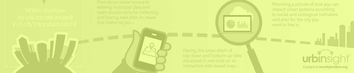
Analyzing and visualizing environmental data for cities globally, the dynamic Urbinsight mapping platform is designed through a community oriented process that leverages residents’ inherent spatial knowledge, enabling users to view relevant and visually appealing map layers as well as input data based on quality of life surveys and parcel audits conducted by local stakeholders.

Its processes visualize urban resource flows, including water, energy, materials and food, from source to sink (nature to nature). With a standardized database structure, urban resource flow information systems introduce a systems perspective to people with diverse backgrounds and to neighborhoods that wish to become more sustainable.

Based on a bottom-up approach to documenting environmental conditions at the neighborhood scale, the custom open source platform weaves together municipal open datasets with bottom-up datasets, revealing opportunities based on ecocity indicators at the levels of individual, household, neighborhood, and city, connecting communities with web-based mapping tools as well as the training and knowledge to holistically explore and measure urban health.


Urban Metabolism

Urbinsight organizes environmental information related to water, energy, waste/materials, food, etc., in a structure that mirrors the urban metabolism. Information is classified by Stages (e.g. Sources, Upstream Infrastructure, Demand, Downstream Infrastructure, and Sinks), and within each Stage, information can be further classified according to the various Nodes or Junctions (e.g. Sources might include Lake, River, Groundwater, Rain, Imported bottles). Further information can be classified according to the water flow network – the connections or tubes that connect the Junctions and that vary by season or time of day.

In this way, Urbinsight can test and implement a data framework that is directly aligned with the actual metabolism, linking all the relevant information on both natural and built environments. This robust and linked approach to the information system can track a wide variety of flows, including energy, food, and materials. In essence, the metabolism becomes a mental map that anyone can use to organize, relate and access information.

This urban metabolism can be analyzed and then visualized for easy communications, similar to maps. If the structure is robust, the various resource flows can be aggregated to different spatial scales as desired – like zooming in or out on a map. The common structure also ensures that many neighborhood environmental Key Performance Indicators (KPIs) become transparent, comparable and much more comprehensive.

Through the Urbinsight Platform the concept of local participation can be applied to urban metabolism. Similar to mapping, a standard protocol is adopted and tested in disparate locations. The result is referred to as a Participatory Urban Metabolism Information System (PUMIS). PUMIS promises to be a timely innovation, as neighborhoods seek to become more self-reliant, and as cities seek to adopt multi-level, collaborative forms of governance.


Visualization of Data

The collection of basic yet essential neighborhood level geospatial information such as land use, parcel lots, streets, public spaces, parks, potential disaster relief spaces that is then mapped using arcGIS can become part of the municipalities’ toolbox for understanding these neighborhoods and planning for future development and risk aversion. In the case of Lima’s San Isidro and Santa Eulalia neighborhoods, the Municipal government reviewed these maps created as part of the Urbinsight initiative and requested similar mapping exercises for all other neighborhoods within the district, using these neighborhoods as precedent studies for planning future initiates.


Geographic Analysis

Utilizing geographic data sourced from partners, Urbinsight participants assess local conditions, and via additional research and auditing on the ground, explore their neighborhoods’ subsystems in context with the geographic analysis using tools to assess the urban metabolism of various resource flows as an “information system”.